
A Map Drawn in the Sand
Kuma Çizilen Harita
Taklamakan Çölü'nde yer değiştiren kum tepeleri arasında devasa bir deve kervanını yürütmek, uzman düzeyinde bir coğrafi yönelim anlayışı gerektiriyordu.
Altı noktalı kelimelere dokun, anlamı çıksın.
Navigating a giant camel kervan across the shifting sand dunes of the Taklamakan Desert required an expert understanding of geographic . Because the wind constantly rearranged the landscape features overnight, relying on visual land structures like hills or trees was completely suicidal for caravan leaders.
Taklamakan Çölü'nde yer değiştiren kum tepeleri arasında devasa bir deve kervanını yürütmek, uzman düzeyinde bir coğrafi yönelim anlayışı gerektiriyordu. Rüzgar gece boyunca manzara özelliklerini sürekli olarak yeniden düzenlediğinden, tepeler veya ağaçlar gibi görsel kara yapılarına güvenmek kervan liderleri için tamamen intihar eylemiydi.
A young boy named Batü spent his childhood learning the secrets of cosmic cartography from his grandfather, who was a master navigator. One morning, when the lead merchant felt confused about the correct direction after a severe storm, Batü stepped forward to offer analytical assistance.
Batü adında genç bir göçebe çocuk, çocukluğunu usta bir navigatör olan büyükbabasından kozmik haritacılığın sırlarını öğrenerek geçirdi. Bir sabah, şiddetli bir fırtınanın ardından baş tüccar doğru yön konusunda kafa karışıklığı yaşadığında, Batü analitik yardım sunmak için öne çıktı.
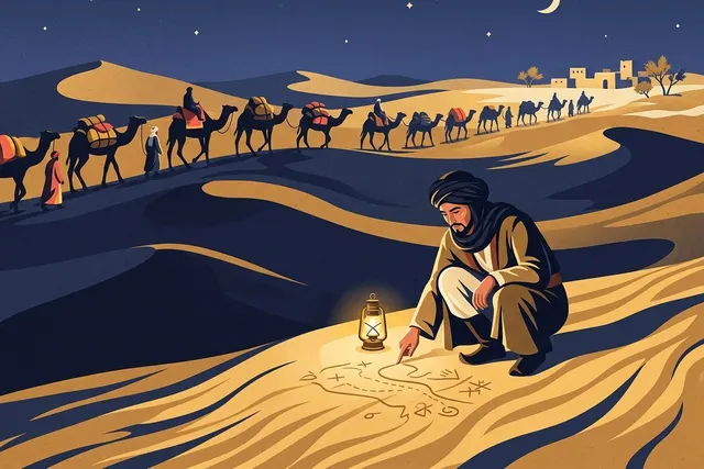
He used a long wooden staff to draw a detailed geographic map directly onto the flat sand surface near the campfire. He the coordinates of distant mountain peaks, hidden underground water wells, and the precise rotational of the northern constellations based on memory parameters.
Kamp ateşinin yanındaki düz kum yüzeyine doğrudan ayrıntılı bir coğrafi harita çizmek için uzun bir ahşap sopa kullandı. Uzak dağ zirvelerinin, gizli yeraltı su kuyularının koordinatlarını ve kuzey takımyıldızlarının kesin dönüş eksenini hafıza parametrelerine dayanarak çizdi.
Batü explained how to read the geometric altitude of the North Star above the sandy horizon during dark night watches. By using simple sticks as shadows and projecting the angle of the early morning sun, he calculated the exact current coordinates of the lost cargo group accurately.
Batü, karanlık gece nöbetleri sırasında kumlu ufkun üzerindeki Kuzey Yıldızı'nın geometrik yüksekliğinin nasıl okunacağını açıkladı. Basit çubukları gölge olarak kullanarak ve sabahın erken saatlerindeki güneşin açısını yansıtarak, kaybolan yük grubunun tam mevcut koordinatlarını doğru bir şekilde hesapladı.
The caravan followed Batü's sand map layout with absolute trust, arriving safely at a green water oasis before their limited hydration packages were completely exhausted. This experience proved that when the physical world shifts constantly under your feet, locking your focus on cosmic laws can reveal the true direction toward safety.
Kervan, Batü'nü kum haritası düzenini mutlak bir güvenle takip ederek, sınırlı su paketleri tamamen tükenmeden önce yeşil bir su vahasına güvenle ulaştı. Bu deneyim, fiziksel dünya ayaklarınızın altında sürekli yer değiştirdiğinde, odağınızı sabit kozmik yasalara kilitlemenin güvenliğe giden gerçek yönü ortaya çıkarabileceğini kanıtladı.

Kelimeler
Hikayedeki 5 yeni kelime, hikayeden örnek cümleleriyle.
The new students attended an orientation meeting to understand the campus layout.
The nomad communities move their felt tents based on changing seasonal grass production.
The architect used a charcoal pencil to sketch the building foundations outline.
The structural rotation around the central axis must be monitored closely for balance safety.
The tech startup maintained a stable growth parameter over three consecutive years.
Ne kadar anladın?
4 kısa soru. Cevabını seç, hemen doğrusunu gör.